![]()
![]()
MAIN SATELLITES FOR ENVIRONMENTAL REMOTE SENSING
ENVISAT (Environmental Satellite):
 Envisat
provides first Earth health scan (Credits:
ESA)
Envisat
provides first Earth health scan (Credits:
ESA)
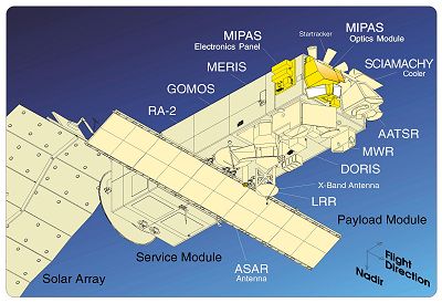 Envisat
Instruments
(Credits:
ESA)
Envisat
Instruments
(Credits:
ESA)
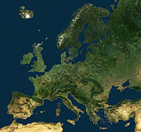 A
united Europe from space: Envisat mosaic, produced using images
acquired during July 2007 by MERIS instrument (Credits:
ESA)
A
united Europe from space: Envisat mosaic, produced using images
acquired during July 2007 by MERIS instrument (Credits:
ESA)
Earth observation satellite.
Sun-synchronous polar orbit.
Height from the Earth: about 800 km.
Launched in 2002 with Ariane 5 launcher from the European launch base in Kourou (French Guyana).
The communication with Envisat satellite suddenly was lost on 8 April 2012, a few weeks after celebrating the tenth year in orbit. On 9 May 2012, the end of the mission was declared, despite the rigorous attempts to re-establish contact. However, ten years of archived data from Envisat continue to be used for many studies.
The satellite was designed to observe continuously and monitor the Earth's surface (landscape topography, vegetation characteristics, crop yields), atmosphere (clouds and precipitations, atmospheric temperature, ozone content), oceans (ocean currents, ocean color) and ice polar caps.
ESA project.
More information: Envisat
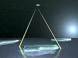
SOHO (Solar Heliospheric Observatory):
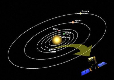 Diagram
showing orbital positions of the planets and SOHO (Credits:
ESA)
Diagram
showing orbital positions of the planets and SOHO (Credits:
ESA)
 Credit:
The SOHO-EIT Consortium: SOHO is an ESA/NASA project of
international cooperation
Credit:
The SOHO-EIT Consortium: SOHO is an ESA/NASA project of
international cooperation
SOHO studies the Sun in depth, in order to monitor the effects of the Sun on the environment.
Launched on 2 December 1995.
Joint project between NASA and ESA.
The most spectacular instrument is EIT (Extreme ultraviolet Imaging Telescope), it can take detailed pictures of the entire solar surface in ultraviolet light. In the SOHO/EIT images, the material in the eruptive prominence is at temperatures of 60,000 - 80,000 K, much cooler than the surrounding corona, which is typically at temperatures above 1 million K. The hottest areas appear almost white, while the darker red areas indicate cooler temperatures.
To find out more about SOHO, flares and how the Sun affects us on Earth, go to ESA portal: click HERE
EARTH EXPLORERS:
These are ESA's missions which involve satellites dedicated to the observation of the atmosphere, biosphere, hydrosphere, cryosphere and Earth's core. The aim is to obtain more information on the interaction among these components and the impact that human activities have on the Earth's natural processes.
GOCE (Gravity Field and Steady-State Ocean Explorer):
 GOCE
data products (Credits:
ESA – AOES Medialab)
GOCE
data products (Credits:
ESA – AOES Medialab)
Launched on 17 March 2009.
The satellite remained in orbit, around the Earth, for 4 years and 8 months; the mission ended on 11 November 2013. This satellite lived more than the 20 months time for which it was designed.
GOCE made measurements of the Earth's gravity field: all the tiny variations in the Earth's gravity force were measured by the instruments of GOCE. For this reason it followed a low orbit at 225 km above Earth. Data from GOCE have been useful to study the ocean currents and the changing of the sea level.
Find out more: GOCE
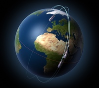
SMOS (Soil Moisture and Ocean Salinity):
 SMOS
orbital path (Credits:
ESA – AOES Medialab)
SMOS
orbital path (Credits:
ESA – AOES Medialab)
 Terrestrial
and atmospheric components of the water cycle (Credits:
ESA/AOES Medialab)
Terrestrial
and atmospheric components of the water cycle (Credits:
ESA/AOES Medialab)
Launched on 2 November 2009.
Duration of the mission: 5 years, then extended until 2017.
The satellite has been designed to observe the soil moisture and ocean salinity, necessary for hydrological studies.
Find out more: SMOS
CryoSat:
 CryoSat
and global warming (Credits:
ESA)
CryoSat
and global warming (Credits:
ESA)
Launched on 8 April 2010.
Orbit: polar at 700 km above Earth.
Nominal duration of the mission: minimum 3 years.
Mission objectives: to observe the ice thickness, marine ice and land ice sheets in particular, over Greenland and Antarctica, in order to detect seasonal changes and determine how and how much the melting of ices can cause a global rise of sea level.
Find out more: CryoSat
Swarm:
 Swarm:
magnetic field satellites get their bearings (Credits:
ESA – P. Carril)
Swarm:
magnetic field satellites get their bearings (Credits:
ESA – P. Carril)
The launch took place on 22 November 2013.
The mission consists of a constellation of three satellites.
Nominal duration of the mission: 4 years.
Mission objectives: to identify and make high resolution measurements of the magnetic signals stemming from Earth’s core, mantle, crust, oceans, ionosphere and magnetosphere, in order to obtain a better understanding of the near-Earth electromagnetic environment and the impact that solar wind has on Earth.
Find out more: Swarm
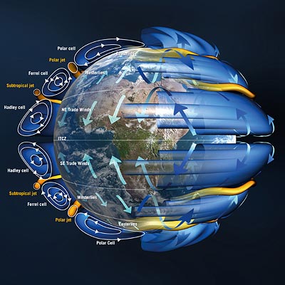
ADM - AEOLUS (Atmospheric Dynamics Mission):
 Earth's
wind patterns (Credits:
ESA/AOES Medialab)
Earth's
wind patterns (Credits:
ESA/AOES Medialab)
Launched on 22 August 2018.
Nominal duration of the mission: 3 years.
Sun-synchronous orbit.
Altitude: about 400 km.
Mission objectives:
- provide global observations of three-dimensional wind fields, in order to study the balance and circulation of wind energy on Earth in more detail;
- improve understanding of phenomena such as El Niño;
- improve the accuracy of weather forecasting;
- improve understanding of climate change.
Find out more: ADM – AEOLUS
EarthCARE (Earth Clouds, Aerosol and Radiation Explorer):
 EarthCARE
(Credits:
ESA – AOES Medialab)
EarthCARE
(Credits:
ESA – AOES Medialab)
Orbit: sun-synchronous polar.
It is implemented in collaboration with JAXA (Japanese Aerospace Exploration Agency).
It is designed to study global warming.
Find out more: EarthCARE
You can discover all ESA missions on ESA portal: click HERE
![]()